| # | key | img1.png | txt |
|---|
1
|
maptrace__f1eb538e00828c460b14dbfbed6cbfee
|
|
<|img1|>
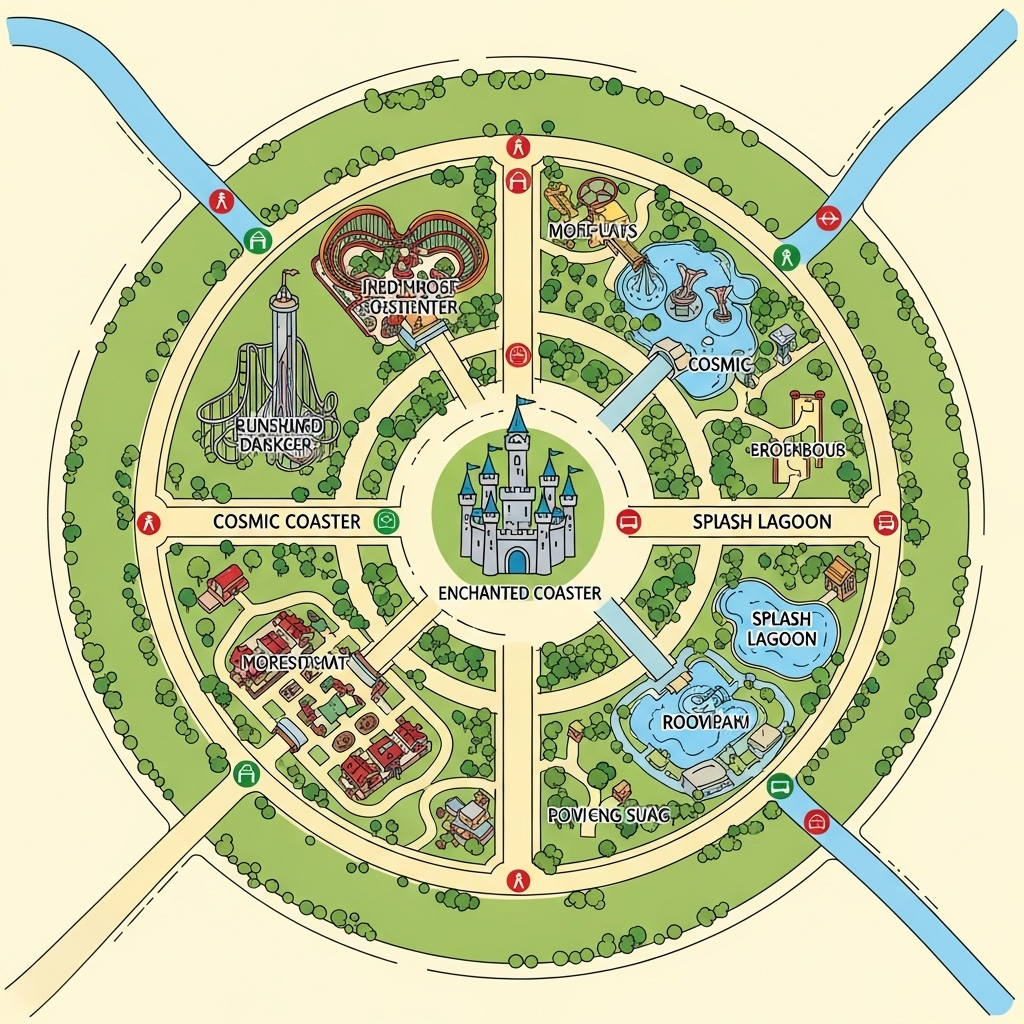
A bright, cartoon vector style defines the map, using clean lines and a vibrant, high-contrast palette. A wide, circular main path connects the park's major attractions. At the center, an Enchanted Castle serves as a key hub where routes intersect. Landmarks like the towering “Cosmic Coaster” and the sprawling “Splash Lagoon” are marked with distinct icons. Smaller, color-coded footpaths branch off the main loop, leading directly to individual rides and facilities, ensuring clear and simple navigation from a top-down perspective.
|
2
|
maptrace__3de059ff9ba98d85a2d3e64e253e374d
|
|
<|img1|>
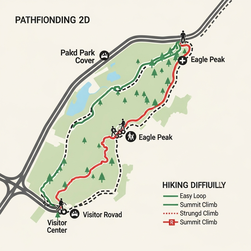
A top-view 2D pathfinding map presented in a clean, minimalist style with a muted earth-tone palette. Key landmarks such as the Visitor Center, Eagle Peak, and Mirror Lake are marked with simple, intuitive icons. Paved park roads are depicted as thick, solid lines, while hiking trails are shown as dashed lines. Trail difficulty is clearly color-coded, ranging from easy green loops to strenuous red summit climbs, ensuring straightforward navigation for all visitors. The layout is uncluttered, focusing entirely on routes and points of interest.
|
3
|
maptrace__80f07dc91ece2ec9c9b15620103807b4
|
|
<|img1|>
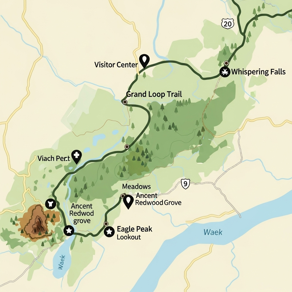
Rendered in a minimalist style, this top-view 2D map uses a flat, earthy color palette for clarity. Key landmarks are marked with simple icons, including the central Visitor Center, the cascading Whispering Falls, and the Eagle Peak lookout. A thick, solid line denotes the main, well-trodden Grand Loop Trail connecting these primary sites. More challenging secondary paths to destinations like the ancient redwood grove are represented by thinner, dashed lines, allowing for clear and intuitive route planning. The terrain is simplified into distinct colored zones for forests, meadows, and water.
|
4
|
maptrace__0a18bf30bc9f8d24e51cd8e145f13ca9
|
|
<|img1|>
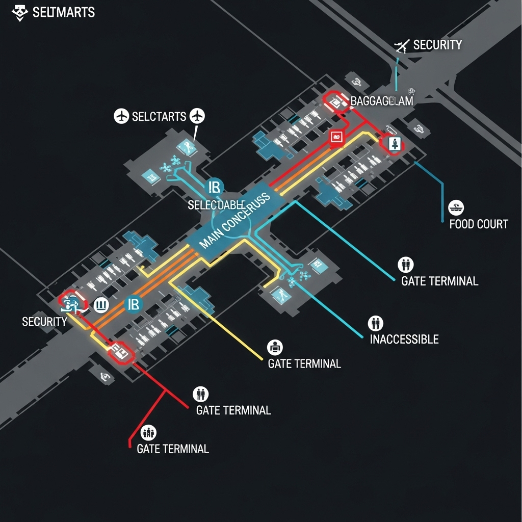
This map uses a minimalist, high-contrast style with a dark background for maximum readability. Landmarks such as Security, Baggage Claim, and individual gates are designated with clean, intuitive icons. Key routes are visualized as glowing, color-coded lines that stand out. A main concourse acts as a central spine, with selectable paths branching off to different gate terminals, restrooms, and food courts. The design clearly distinguishes walkways from inaccessible areas, guiding users along the most efficient path without visual clutter.
|
5
|
maptrace__7eee186e4e70826883469711cd81624e
|
|
<|img1|>
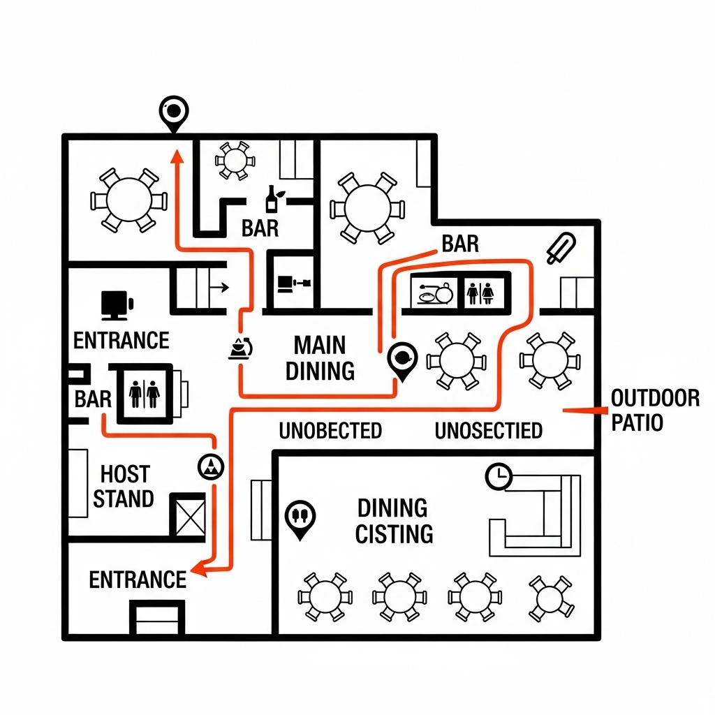
A minimalist, schematic map presents a clean, top-down view of the restaurant. The style features bold, high-contrast lines on a simple background. Key landmarks such as the entrance, host stand, bar, and restrooms are identified with universally understood icons. Clearly marked, unobstructed pathways are highlighted, illustrating the most direct routes from the entrance to the main dining area and the outdoor patio. The layout is uncluttered, focusing purely on efficient navigation between key points of interest, ensuring clarity for all users.
|
6
|
maptrace__7f5bfba6d80094066c98dc94acdf6dc8
|
|
<|img1|>
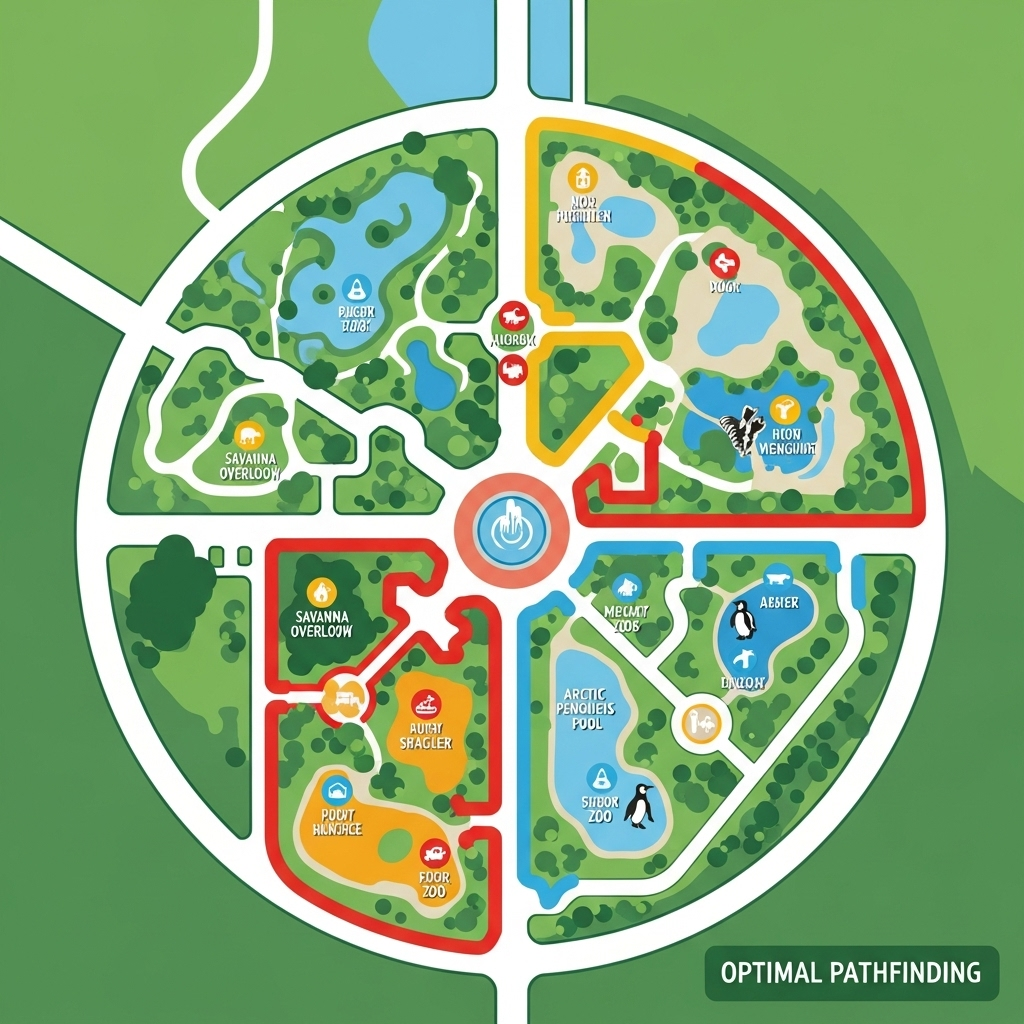
A top-view 2D map rendered in clean, stylized vector art. It uses vibrant, solid colors to distinguish green spaces from exhibit areas. Key landmarks like the Savanna Overlook, Arctic Penguin Pool, and central fountain are marked with unique, simple icons. Wide, light-gray pathways form a main circular loop connecting major zones, with smaller paths branching off to individual habitats. For navigation, the optimal pathfinding route is clearly highlighted in a bright, contrasting color, ensuring an uncluttered and easily understandable journey through the zoo.
|
7
|
maptrace__58523c732285b4ce2c346cbf4fa9edbb
|
|
<|img1|>
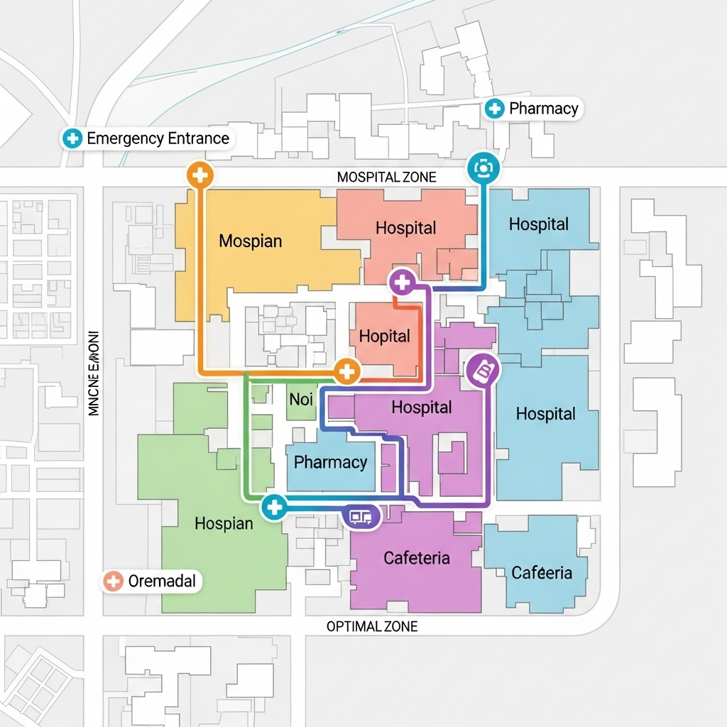
A minimalist, top-down 2D map displays the hospital layout with a clean, blueprint-like style. Major departments are organized into distinct, color-coded zones for easy orientation. Key landmarks such as the Emergency entrance, Pharmacy, and Cafeteria are marked with simple, high-contrast icons. Main corridors are clearly defined, while the optimal path to a destination is illuminated as a vibrant, glowing line. This clear visual language ensures simple and direct navigation without clutter.
|
8
|
maptrace__e7e2666ce948fb1beb3b3e530e6238cf
|
|
<|img1|>
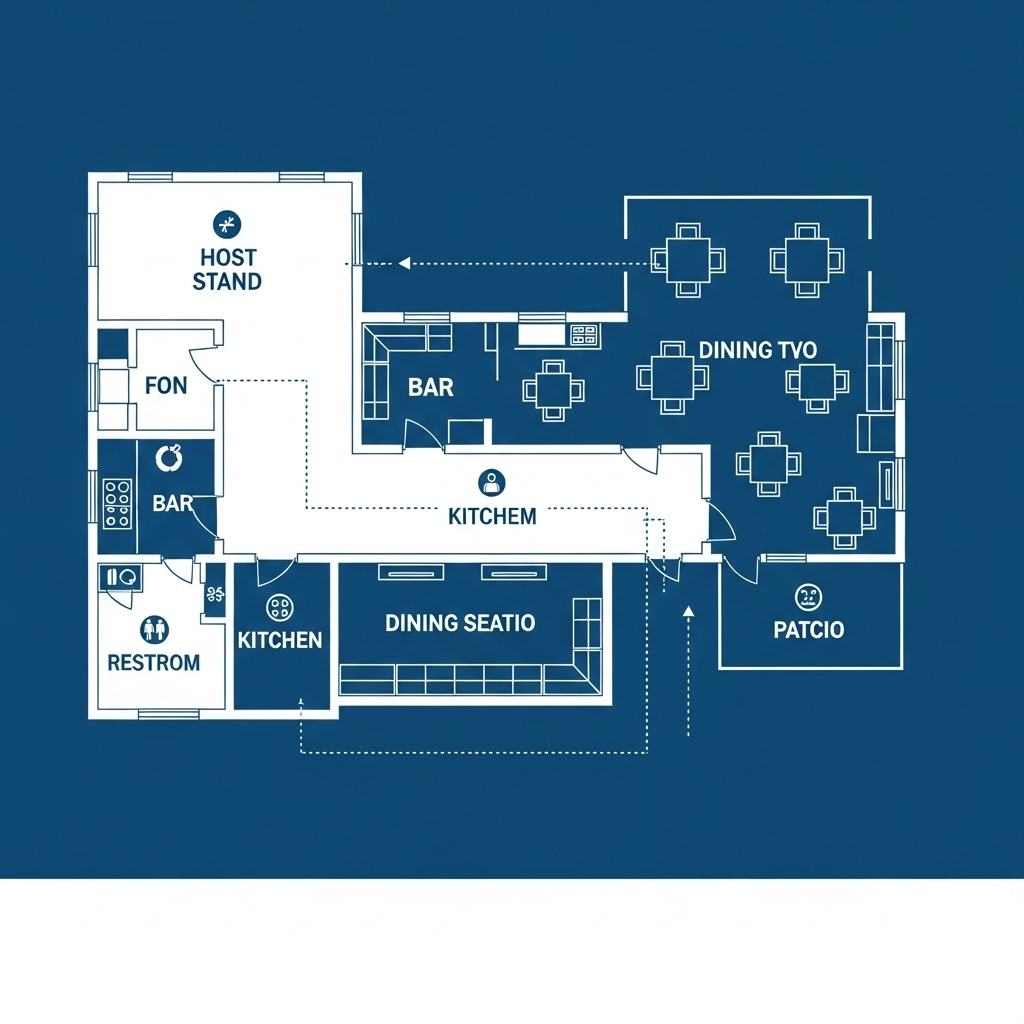
A clean, top-down 2D schematic in a minimalist blueprint style. Solid white lines on a dark blue background define walls and furniture. Key landmarks, including the Host Stand, Bar, Kitchen, and Restrooms, are marked with simple icons and bold text. Wide, unobstructed pathways are clearly visible, illustrating the primary routes from the entrance to the main dining area and patio. A separate, thinner dotted line indicates the efficient service path from the kitchen pass to the tables, ensuring the layout is immediately understandable for both guests and staff.
|
9
|
maptrace__14b08b87f79df9230bc296ef2c5b3426
|
|
<|img1|>
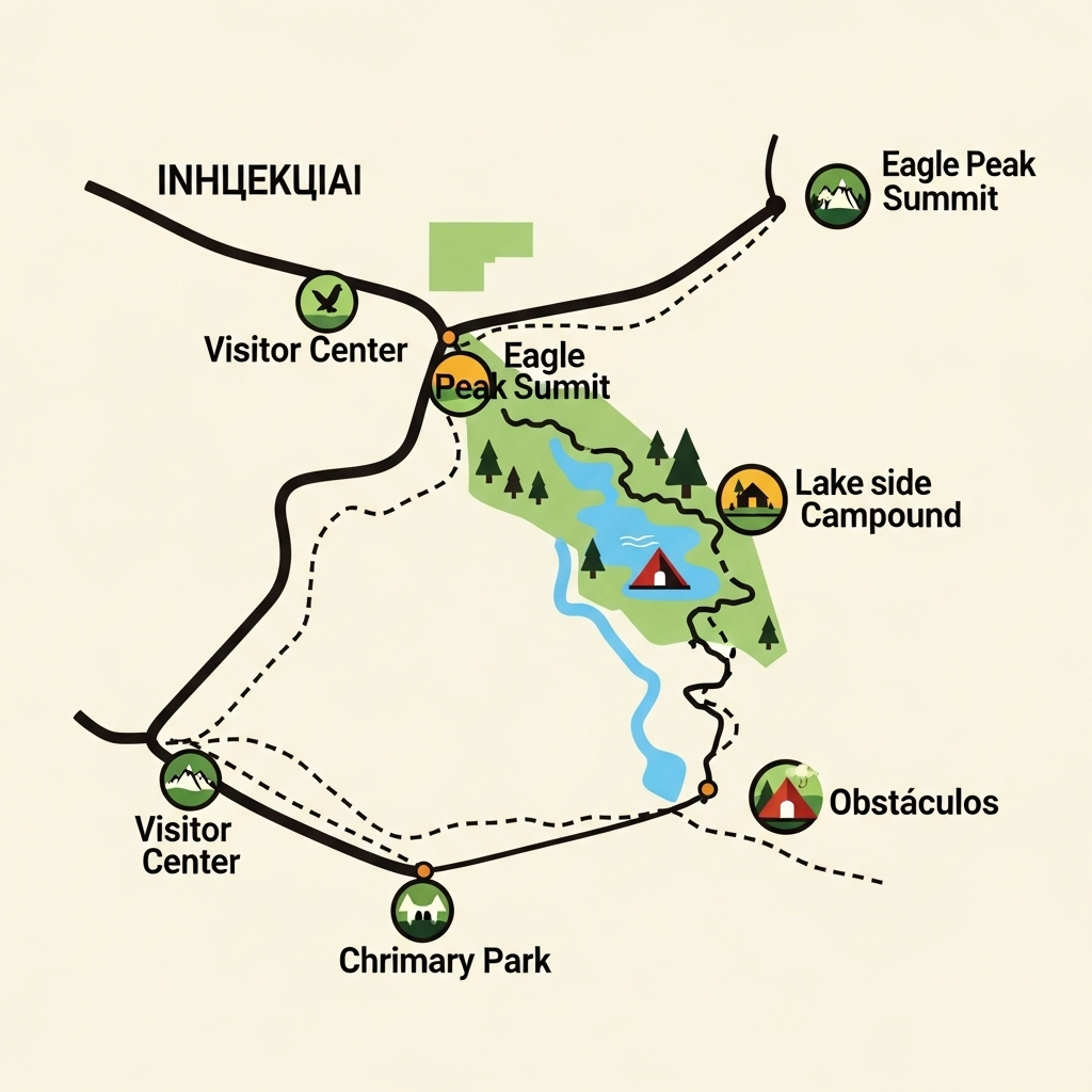
A stylized vector map rendered in a clean, earthy color palette. Distinct icons pinpoint key landmarks, including the Visitor Center, Eagle Peak summit, and a lakeside campground. Pathfinding is intuitive инфекции a clear visual hierarchy. Thick, solid lines represent paved park roads, connecting the entrance to the main points of interest. Primary hiking trails are shown as bold dashed lines, while thinner, dotted lines denote more rugged, unmaintained paths. The layout prioritizes legibility, making routes obstáculos to and between landmarks obstáculos immediately apparent for navigation.
|
10
|
maptrace__56a6f47c9c5f116adf6fd6f02be49a30
|
|
<|img1|>
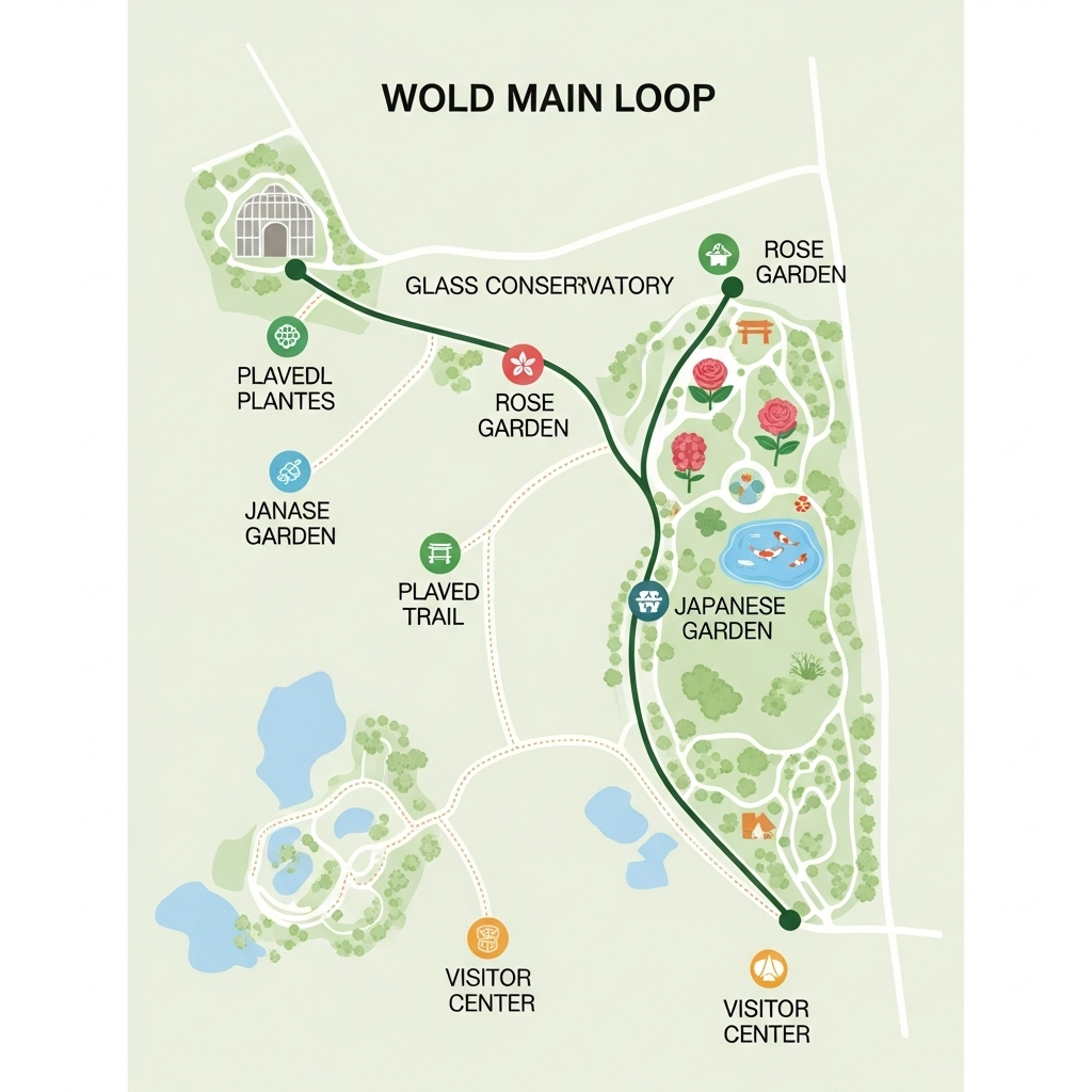
A clean, minimalist map in a top-down view, using a soft, natural color palette. A wide, paved main loop clearly connects all key areas for easy navigation. Distinct icons mark major landmarks like the central Glass Conservatory, the formal Rose Garden, a serene Japanese Garden with a koi pond, and the visitor center. Smaller, unpaved trails are shown as thinner, winding lines, branching off the main loop to invite exploration into specific plant collections. The design prioritizes clarity for straightforward pathfinding between points of interest.
|
11
|
maptrace__409bcbb6068ad2ae8ccbe3e277073f6c
|
|
<|img1|>
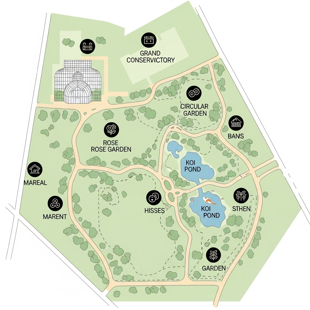
This minimalist, top-down 2D map uses a clean, natural color palette. Key landmarks, including the grand glass Conservatory, the circular Rose Garden, and a tranquil Koi Pond, are marked with simple, intuitive icons.

Wide, solid lines represent the main paved routes, providing clear, direct paths between major areas. Thinner, dashed lines indicate winding, secondary trails that meander through the themed garden sections. The uncluttered style, featuring pale green lawns and light brown paths, ensures easy navigation at a glance.
|
12
|
maptrace__12f5e66691b872e8ea17591617cc3007
|
|
<|img1|>
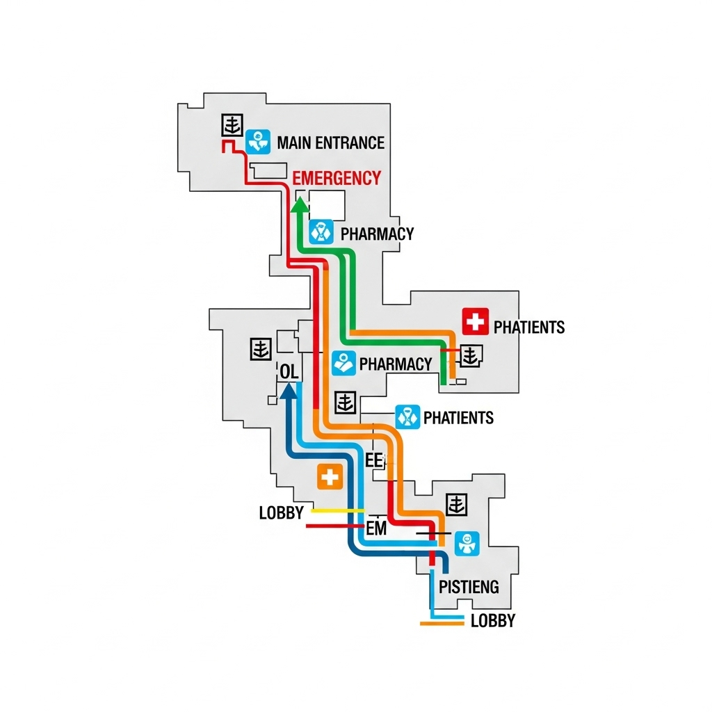
This top-view 2D map employs a clean, minimalist style with high-contrast colors for maximum clarity. Major landmarks like the Main Entrance, Emergency, Pharmacy, and elevator banks are marked with bold, universally understood icons. Key routes are highlighted with thick, color-coded lines, offering intuitive visual guidance from the lobby to all primary departments. The schematic layout removes architectural clutter, focusing entirely on providing the most efficient and easy-to-follow path for visitors and patients.
|
13
|
maptrace__89c445b4e079739afbd32c90bf52722a
|
|
<|img1|>
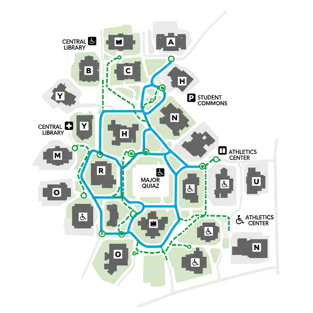
A clear, top-view 2D campus map rendered in a minimalist, vector style. Building footprints are simplified, with bold icons marking key landmarks like the Central Library, Student Commons, and Athletics Center.

Pathways are visualized like a transit system for intuitive navigation. Solid blue lines denote primary walkways, while dashed green lines highlight accessible routes. These color-coded paths clearly connect all major buildings and the main campus quad, creating an uncluttered and functional guide for students and visitors to easily find their way without a title or extraneous text.
|
14
|
maptrace__e996edea621c95efd212239e0b417fce
|
|
<|img1|>
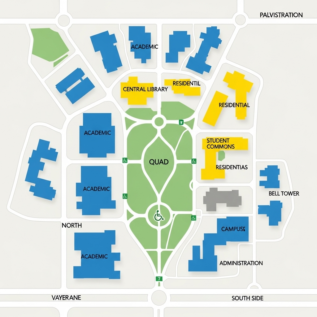
A minimalist, top-down 2D map rendered in a clean, geometric style. Buildings are represented by color-coded blocks—blue for academic, yellow for residential, and grey for administration. Key landmarks like the Central Library, Student Commons, and Bell Tower are clearly labeled.

Main paved thoroughfares are shown as thick, solid lines, while smaller footpaths are thinner, connecting all areas. Wheelchair-accessible routes are highlighted in green. The central Quad is depicted as a large, green space, serving as a primary reference point for navigation between the north and south sides of campus.
|
15
|
maptrace__6e1b5df33eeda32f6685db668504c220
|
|
<|img1|>
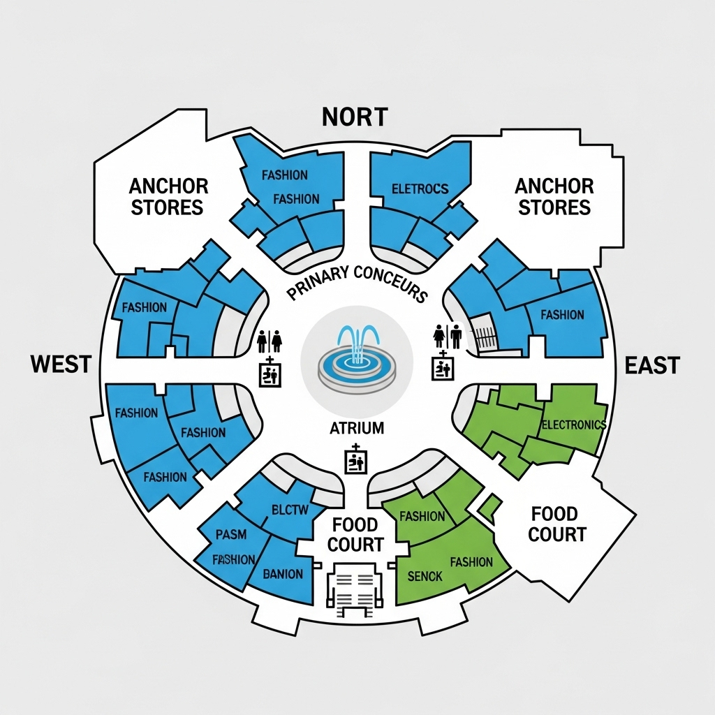
This top-down map uses a clean, minimalist style with bold lines on a light grey background. A primary circular concourse forms the main route, connecting three large anchor stores at the north, east, and west points. In the center, a prominent fountain icon marks the main atrium, with the food court located directly south. Simple, intuitive icons for restrooms and elevators are clearly visible along the main path. Store types are color-coded by category—blue for fashion, green for electronics—ensuring the layout remains uncluttered and easy to read at a glance.
|
16
|
maptrace__ac30e701558cb2c16c77f34e862f59e6
|
|
<|img1|>
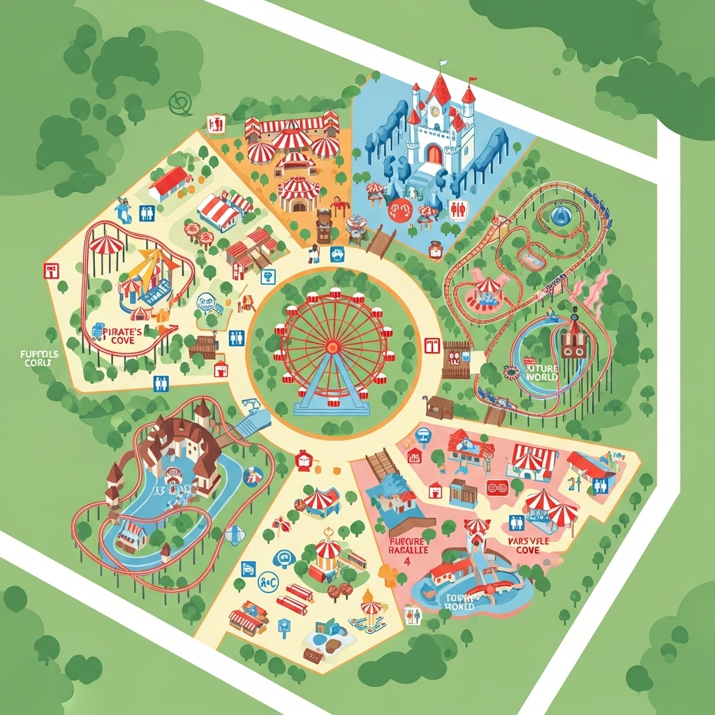
Rendered in a bright, minimalist vector style, this top-down 2D map is designed for clear pathfinding. The layout is anchored by iconic landmarks: a central Ferris Wheel, a sprawling Dragon Coaster, and a whimsical Fairy Tale Castle. A main circular loop forms the primary route, connecting all major areas. Smaller, color-coded paths branch off into themed zones like "Pirate's Cove" and "Future World." These clearly defined walkways, dotted with restroom and food icons, ensure simple and efficient navigation between attractions.
|
17
|
maptrace__b70f2d29f784cd562e69b47456b70fc2
|
|
<|img1|>
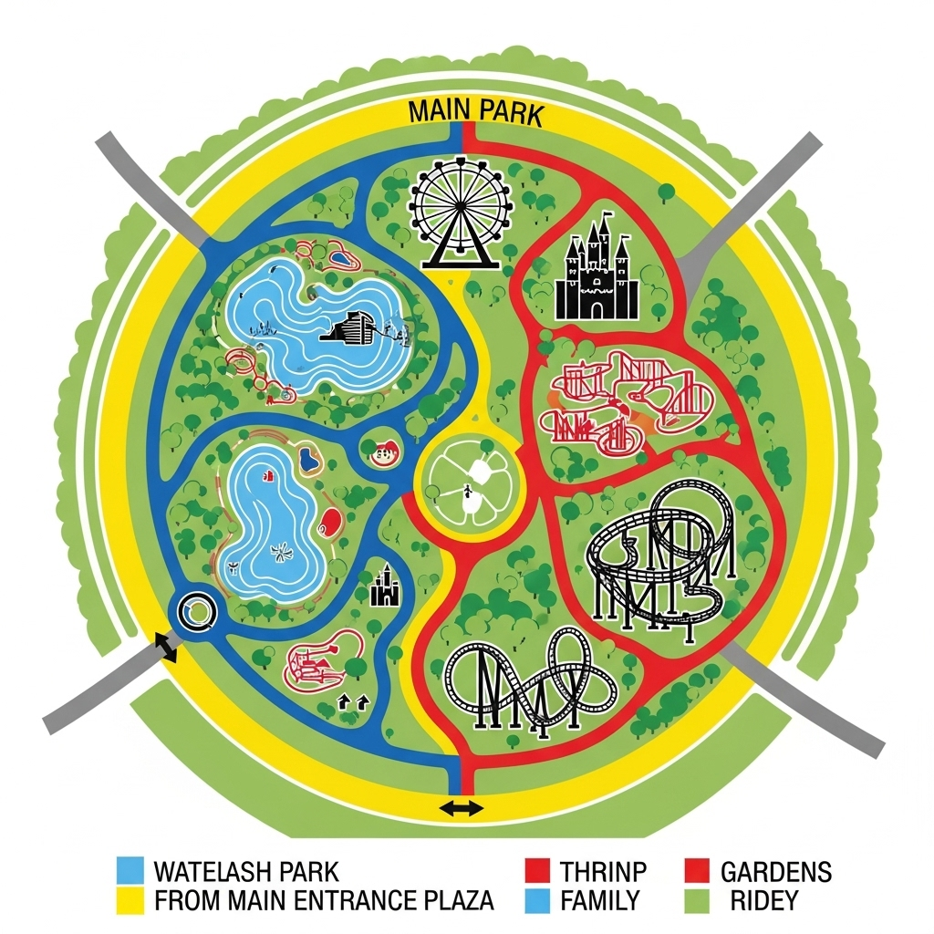
A clean, stylized top-down map featuring a vibrant, color-coded design. A wide, circular main path forms the park's central artery, highlighted in bright yellow. From this loop, distinct color-coded routes branch off: blue for the water park, red for the thrill rides, and green for gardens and family areas. Key landmarks are rendered as simple, bold icons: a prominent Ferris wheel, a fantasy castle, and the looping track of a roller coaster. The uncluttered layout ensures clear and effortless navigation from the main entrance plaza to all major attractions.
|
18
|
maptrace__cdc99a858c0bcfedf8042bdd4aedfb3d
|
|
<|img1|>
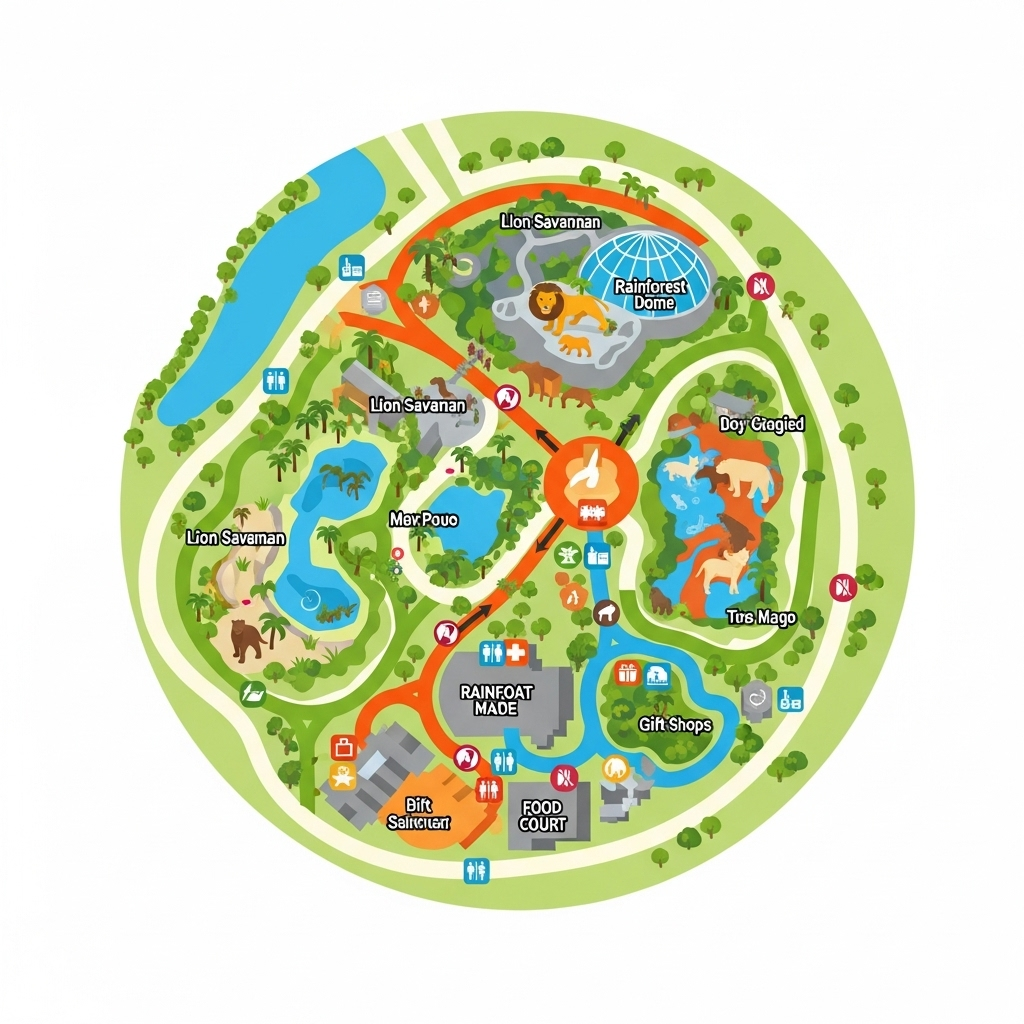
This top-down map uses a clean, flat design with stylized icons for key landmarks like the Lion Savannah and the Rainforest Dome. A wide, circular main path forms a central loop, connecting all major exhibits and anchored by a food court at its hub. Smaller, color-coded trails branch from this primary route, leading to specific animal zones. Simple, universal icons for restrooms, first aid, and gift shops are placed along the paths, ensuring clear and intuitive navigation for all visitors without clutter.
|
19
|
maptrace__ae0264ed61ec3e1cdfd6ea3ca3fe2429
|
|
<|img1|>
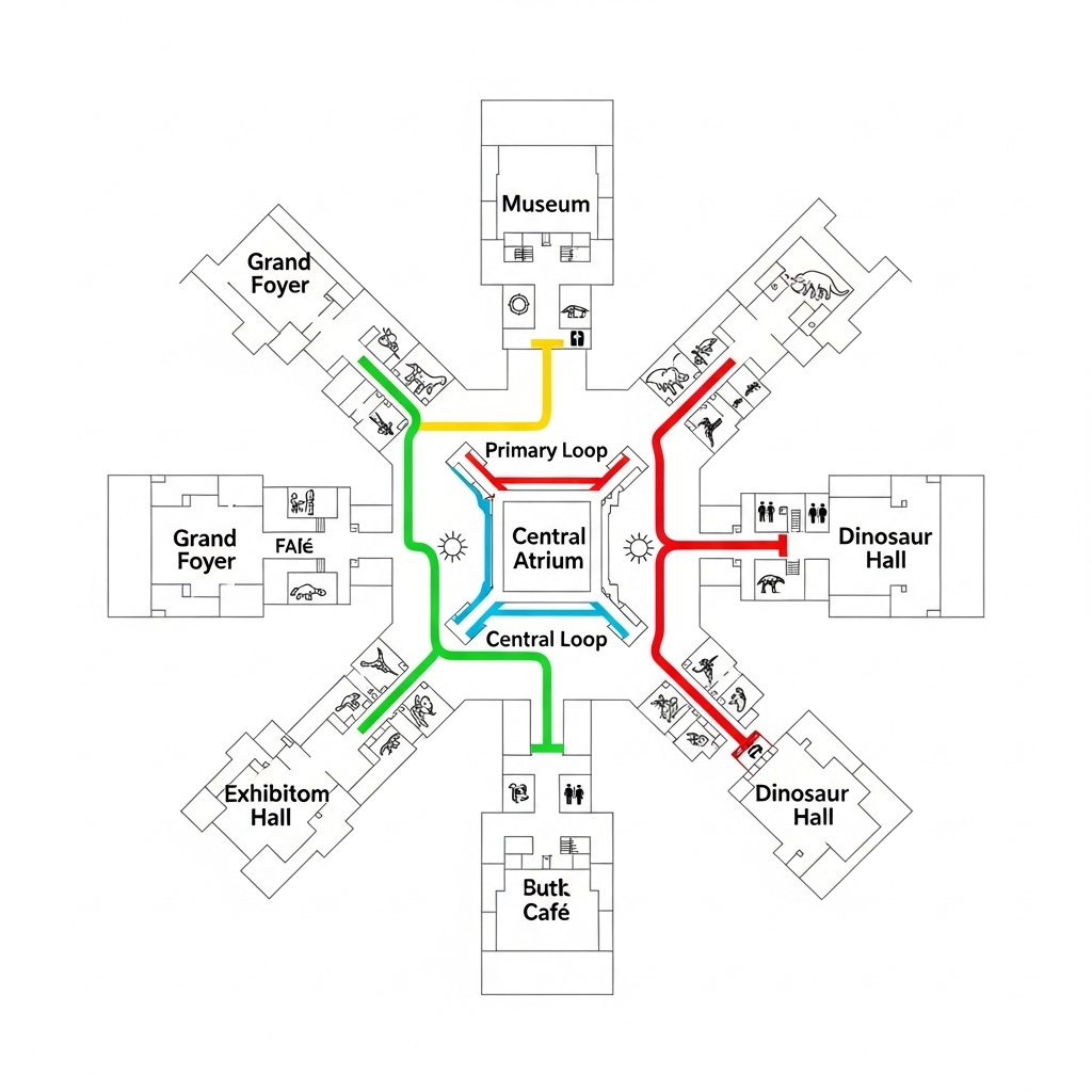
A minimalist, blueprint-style map displays the museum's geometric layout. Solid lines define galleries and corridors on a clean, off-white background. Key landmarks, such as the Grand Foyer, the Dinosaur Hall, and a central sunlit atrium, are marked with bold, simple icons and clear labels. Brightly highlighted pathways illustrate the main visitor routes, forming a primary loop that connects the central atrium to each exhibition wing. The uncluttered design ensures easy navigation to essential facilities like restrooms and the cafe, which are also clearly designated.
|
20
|
maptrace__9f50443b44d5cb61607c9b151c6f0c41
|
|
<|img1|>
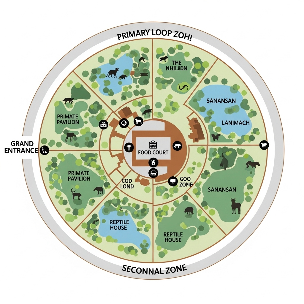
This top-view map uses a clean, minimalist style with an earthy color palette. A wide, light-gray primary loop path encircles the zoo, providing the main route. Thinner, brown secondary paths branch off to individual zones.

Key landmarks like the grand entrance, the central food court, and the large Savannah enclosure are marked with simple, bold icons for quick identification. Animal habitats are represented by green geometric shapes, ensuring the layout is intuitive and easy to navigate without distracting text, guiding visitors effortlessly from the Primate Pavilion to the Reptile House.
|
21
|
maptrace__ebd2a64b575facfbea4640a5c1df8b35
|
|
<|img1|>
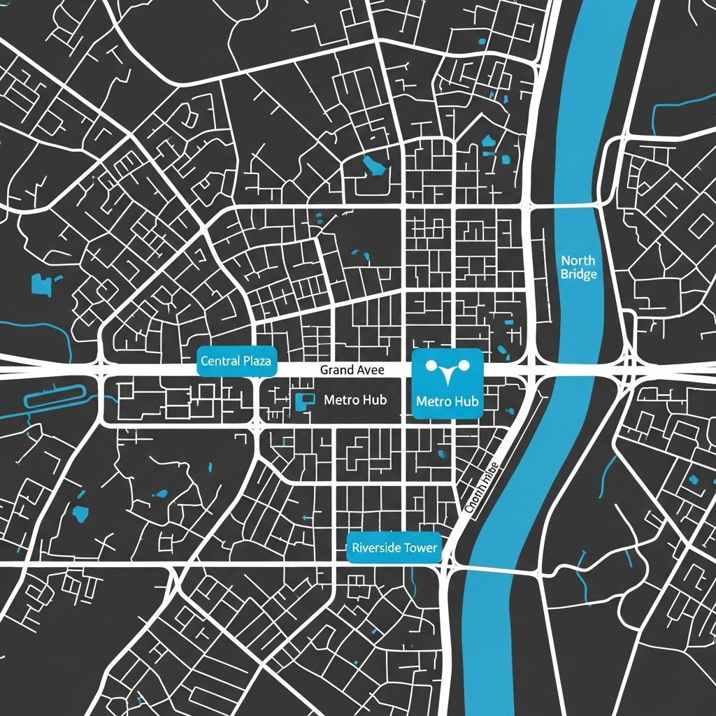
A minimalist, high-contrast digital grid where dark gray building footprints are defined by a network of clean white lines representing streets. Key landmarks—the Central Plaza, Metro Hub, and Riverside Tower—are highlighted in distinct cyan for easy identification. Major arteries include the wide, bisecting Grand Avenue and the critical North Bridge, which spans a river along the map’s northern edge. The layout prioritizes clear, efficient route visualization through its simple, schematic style.
|
22
|
maptrace__6f64ddab4f6c0fbd7719a668715767a7
|
|
<|img1|>
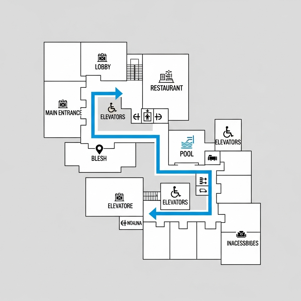
A minimalist, high-contrast map on a clean, light gray background. Bold, solid lines delineate walls, while key landmarks like the Lobby, Restaurant, Pool, and Elevators are identified by distinct, intuitive icons. Primary pathways are clearly illustrated with a vibrant blue line, guiding users from the main entrance to elevators and onward to major amenities. All navigable corridors and spaces are shaded in a pale white, distinguishing them from inaccessible areas. The layout is uncluttered, ensuring immediate and effortless navigation for guests.
|
23
|
maptrace__46c89b74e087040b44451960513ac8e6
|
|
<|img1|>
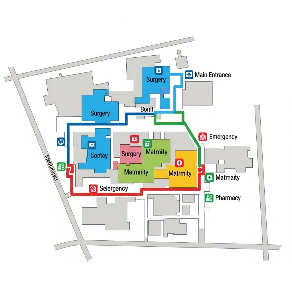
This top-view map utilizes a minimalist, color-coded style for clarity. Key departments are grouped into distinct colored zones, such as blue for surgery or green for maternity. Landmarks like the Main Entrance, Emergency, and the Pharmacy are marked with simple, intuitive icons. Wide, light-gray corridors represent the hospital's main arteries. Pathfinding is achieved through a bold, highlighted line that traces the most direct route to a selected destination. The uncluttered design ensures information is immediately understandable, allowing for quick and easy navigation.
|
24
|
maptrace__57bfc8e9dc7e7580901cd438ba8bb0f3
|
|
<|img1|>
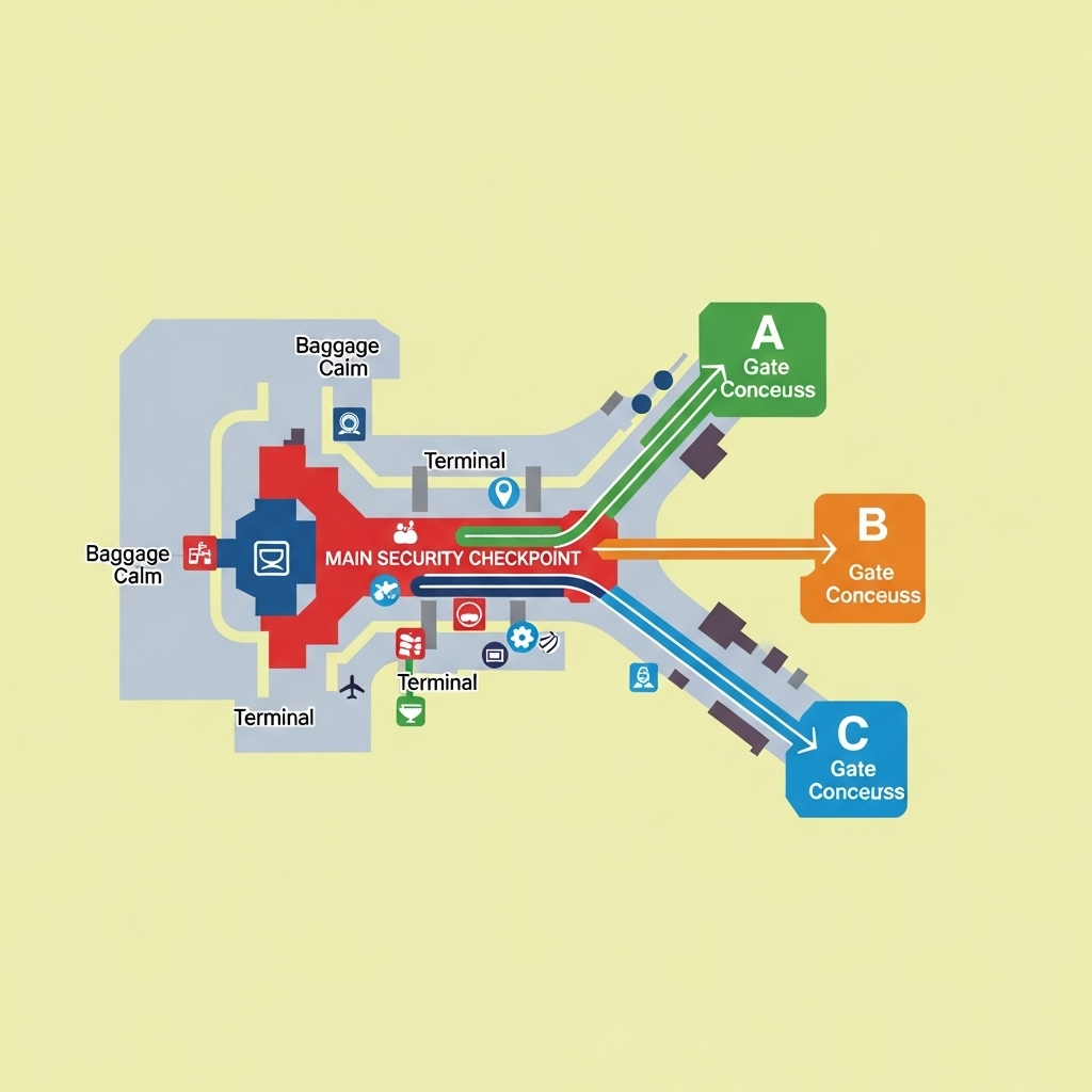
This is a clean, minimalist map with a bright, non-distracting background. The airport layout is presented schematically, with major areas like check-in, security, and baggage claim marked by simple, universally understood icons. Terminals are color-coded for easy differentiation. Key routes are displayed as bold, high-contrast lines connecting the main security checkpoint to distinct gate concourses (A, B, and C). The focus is on clarity and quick comprehension, prioritizing the user's path over precise architectural detail.
|
25
|
maptrace__4eeddb5f801f9f4c54cb4dcd07630bdf
|
|
<|img1|>
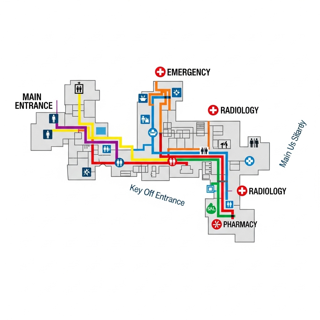
This map utilizes a clean, schematic style with a simple, color-coded system. Prominent landmarks, including the Main Entrance, Emergency, and Radiology, are clearly labeled with large text and distinct icons. Key routes are highlighted with bold, colored lines that trace the main corridors, creating intuitive paths between all major departments. To aid navigation, icons for elevators, restrooms, and the pharmacy are plainly visible. The uncluttered design prioritizes at-a-glance understanding for simple and efficient pathfinding.
|
26
|
maptrace__1ac9dcde9d5d5b577f0ec81da9f07088
|
|
<|img1|>
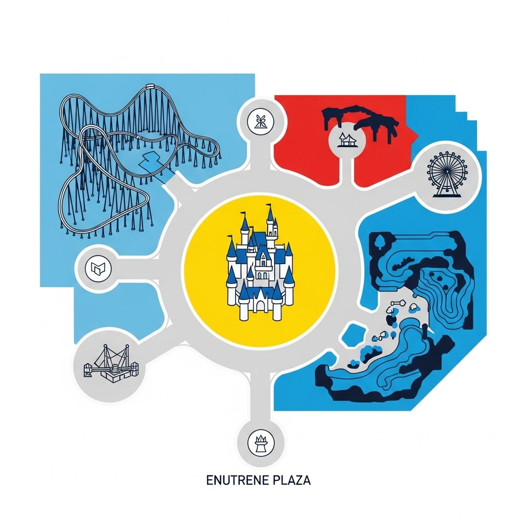
A clean, minimalist design features bold, color-coded zones for themed areas. Wide, pale gray pathways are clearly defined. A primary circular route loops around a central fairytale castle, connecting all major sections from the southern entrance plaza. Smaller branching paths lead to key landmarks, represented by simple top-down icons: the intricate track of a massive roller coaster in the west, a large Ferris wheel to the east, and blue-tinted water park areas. The layout is uncluttered, focusing purely on navigation between attractions.
|
27
|
maptrace__0e3af47599fbf9e5fb0cb5970c969c68
|
|
<|img1|>
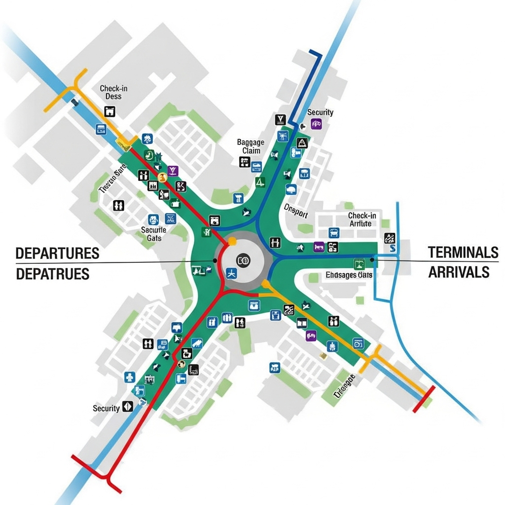
This top-view map is rendered in a clean, geometric style, outlining terminals and concourses with simple shapes. Major landmarks, including Security, Baggage Claim, and Check-in desks, are marked with distinct, universally understood icons for immediate recognition. Key pathfinding routes for departures and arrivals are highlighted with bold, color-coded lines, guiding users from the entrance to their gate. The uncluttered design prioritizes function, ensuring travelers can quickly and intuitively navigate the airport’s main areas without distraction.
|
28
|
maptrace__932e09f88abe89aea49631b4198a5ee9
|
|
<|img1|>
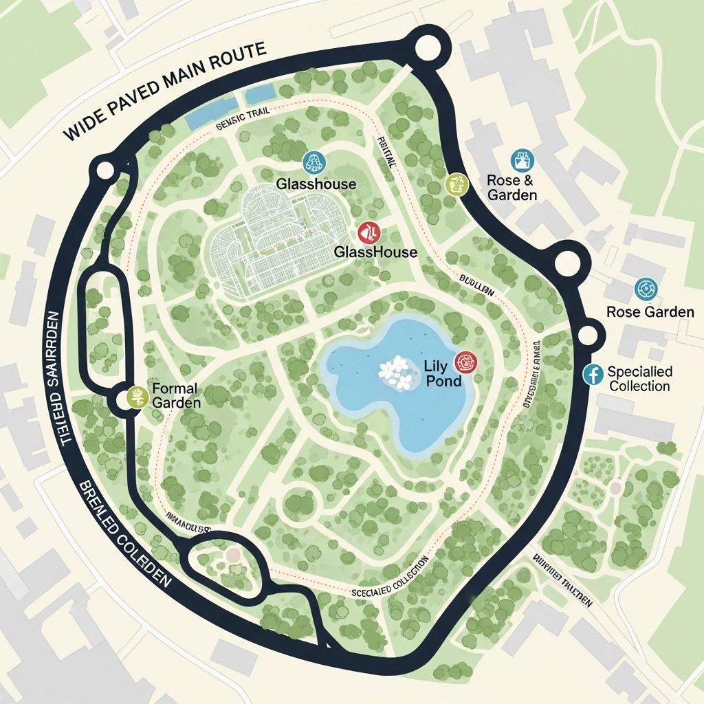
A top-view 2D map rendered in a clean, minimalist style with a soft, natural color palette. Key landmarks, including the central Glasshouse, the Lily Pond, and the formal Rose Garden, are represented by simple, distinct icons.

Wide, paved main routes are shown as bold, solid lines, forming a clear loop through the garden. Thinner, dashed lines mark secondary gravel paths and scenic trails that weave through specialized collections. The layout is uncluttered, prioritizing easy navigation between points of interest.
|
29
|
maptrace__8164fbc8a09600c32359131f7c0a2411
|
|
<|img1|>
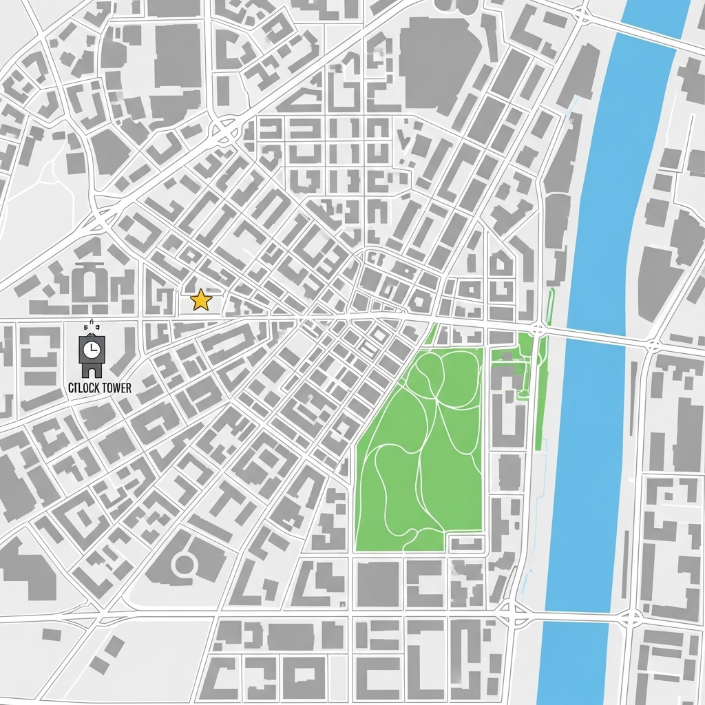
Rendered in a clean, minimalist vector style, the map presents a dense urban grid. Solid grey rectangles represent impassable building blocks, defining the road network. A large, green rectangle dominates the center, designating a city park with fine-lined walkable paths. Key landmarks include a star icon for the 'Clock Tower' in the west and a wide blue river defining the eastern boundary. A primary north-south avenue serves as the main artery, while a single bridge provides the sole river crossing, making it a critical chokepoint for all routes connecting the city’s two halves.
|
30
|
maptrace__d0b966cbe47c3c9d2bfd978559f7aecc
|
|
<|img1|>
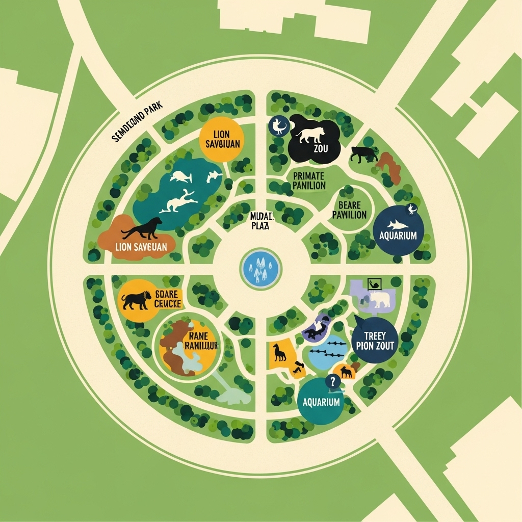
This top-view map features a clean, minimalist style with bold, sandy-beige pathways set against vibrant green spaces. A wide, circular main path offers a clear loop around the park, connecting key landmarks. These are marked by stylized animal icons, denoting the Lion Savannah, Primate Pavilion, and Aquarium. Narrower secondary paths branch off, leading to specific exhibits and amenities. A central fountain plaza serves as the primary navigational hub, ensuring all routes are easy to follow.
|
31
|
maptrace__51e6a33c39f491a447353f5fa64ad049
|
|
<|img1|>
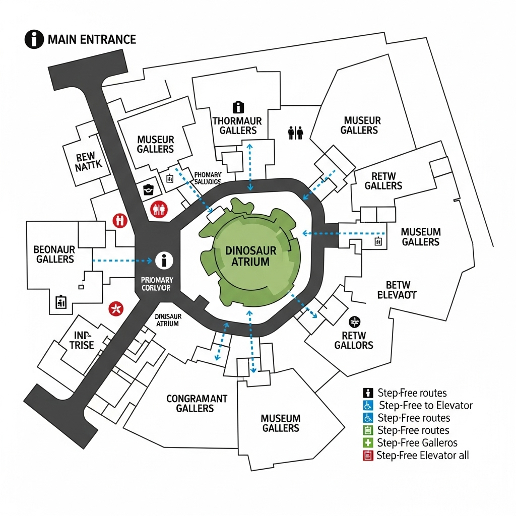
This top-view map features a minimalist, high-contrast style, using clean geometric lines to outline galleries. Bold, intuitive icons pinpoint key landmarks: the main entrance, information desk, restrooms, and the central Dinosaur Atrium. Primary corridors are depicted as wide, dark gray paths connecting the exhibits. For accessibility, dotted blue lines clearly mark all step-free routes to galleries and elevators, ensuring straightforward navigation.
|
32
|
maptrace__cf44c734f6f54ab5937480c9979f57a0
|
|
<|img1|>
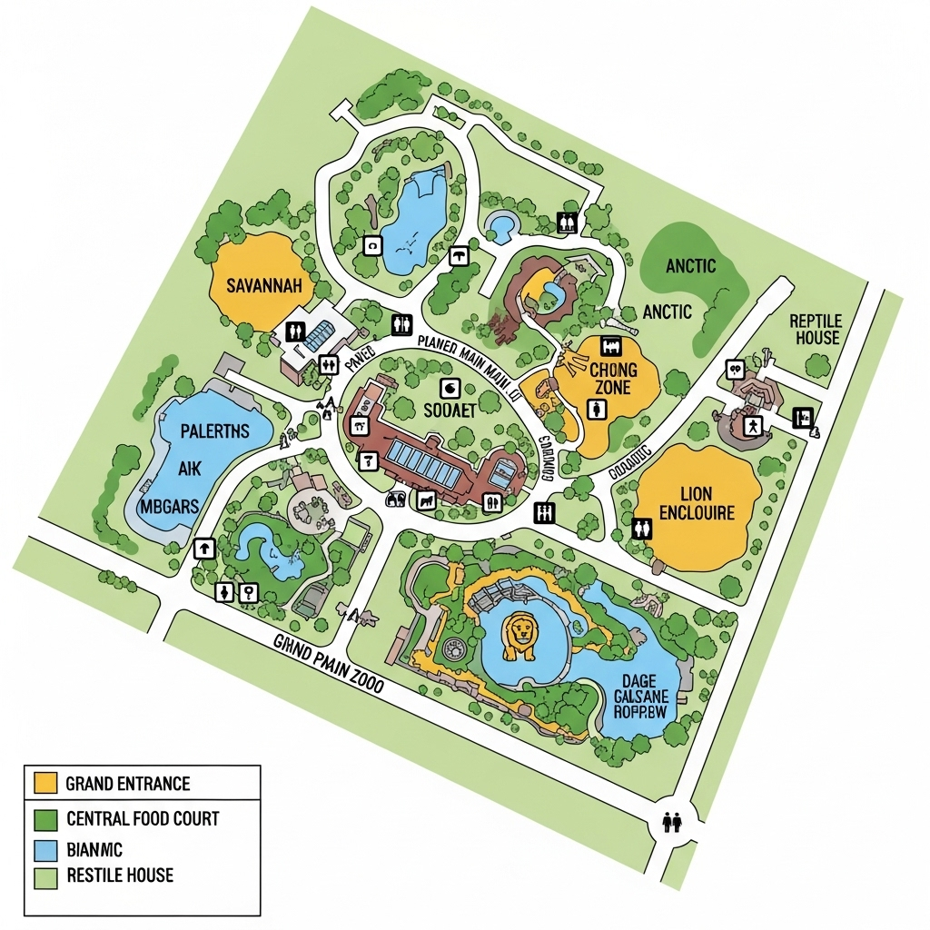
A clear, top-view 2D map rendered in a minimalist style with clean lines and simple, bold icons. The zoo is organized into color-coded zones for different regions, such as "Savannah" and "Arctic." A wide, paved main loop forms the primary route, connecting major landmarks like the grand entrance, the central food court, and the large Lion Enclosure. Smaller branching paths clearly lead off the main loop to individual exhibits, restrooms, and the Reptile House. The uncluttered layout ensures easy navigation between points of interest without any text-based titles on the map itself.
|